Project Overview
This project, completed as part of ENGGEN 726: Climate Adaptation of Infrastructure and supervised by Dr. Theuns Henning, examines how the Mission Bay shoreline in Auckland may need to respond to coastal hazards under future sea-level rise. The study area covers approximately 1.45 km of coast along Tamaki Drive. The analysis considers coastal inundation and erosion, and suggests a preliminary staged adaptation pathway that may inform possible options for the area.
Study Hazards
Two types of coastal hazards are considered in this study.
Coastal inundation — marine flooding driven by tides, storm surges and sea-level rise (SLR), which may increase in frequency and extent as sea level rises. The analysis combines four storm-tide annual exceedance probability (AEP) levels with SLR scenarios from 0.5 m to 2.0 m.
Coastal erosion — progressive landward retreat of the active beach edge under waves, storms and SLR. The assessment focuses on the sandy pocket at Mission Bay, where the shoreline is expected to retreat over time, based on the ASCIE regional projections for 2050, 2080 and 2130.
Risk Assessment
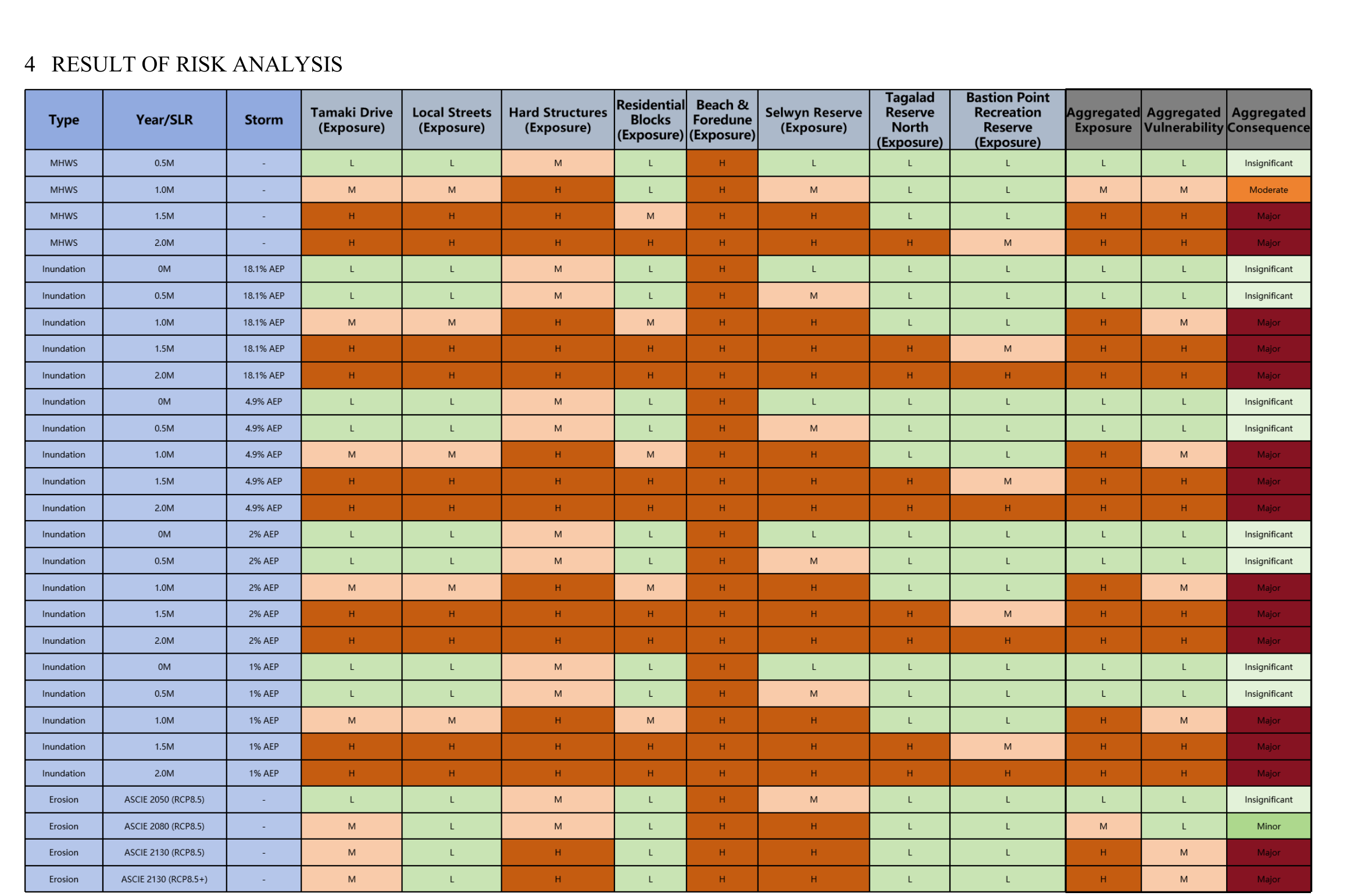
Asset-level exposure to each hazard is classified as Low / Medium / High across eight asset classes, including Tamaki Drive, hard coastal structures, residential blocks, the beach and foredune, and public reserves. The aggregated results suggest that exposure increases notably as sea-level rise approaches 1.0–2.0 m, with beach and reserve areas potentially facing the highest exposure.
Adaptation Pathway
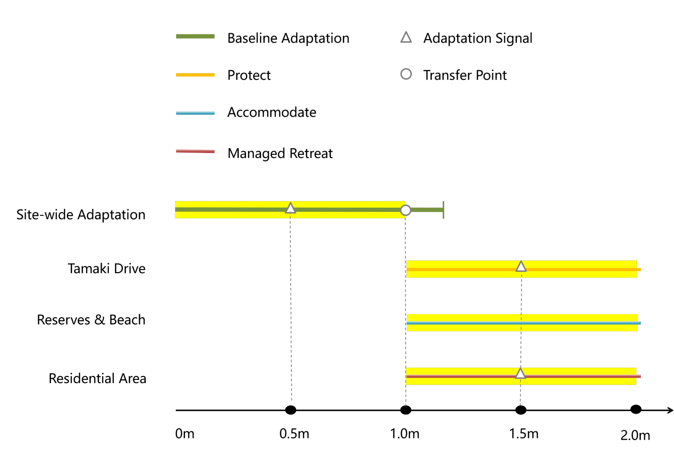
A staged pathway is suggested for the area. In the earlier stage (up to approximately 1.0 m of sea-level rise), maintenance and incremental defence may be sufficient. Beyond that point, Tamaki Drive, as a lifeline route, may require stronger protection; public reserves and the beach may be expected to accommodate water; and first-row residential properties may need to consider gradual adaptation, with managed retreat potentially required beyond approximately 1.5 m of sea-level rise.
Key Observations
- Exposure appears to be driven mainly by the sea-level rise step, rather than the storm-tide AEP level.
- The beach, foredune and the seaward frontage of Selwyn Reserve may be the most exposed assets.
Documentation
The project report and presentation slides are available below: